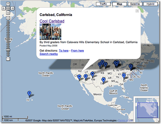
Our City Podcast: Interactive Map
Our City Podcast has a new feature: an interactive map. I used the new My Maps feature of Google Maps. The map has a marker for each episode of Our City Podcast. Click a marker and information about that podcast episode is displayed. Click the link inside the info bubble and you are taken to the episode's show notes where you can listen. Each time the podcast is updated, I'll also update the map. Recent episodes are indicated by a red marker. Notice you can zoom in and out using the controls on the left. You can also click the drag your mouse to move the map. Pretty cool, huh?
As you can see on the map, there are several episodes from Illinois, Nebraska, and Pennsylvania (probably because of the podcasting workshops and conference sessions I've conducted in those locations). I'd love to receive episodes from more states and more countries! Many resources are provided to help you create the recording. You can subscribe in iTunes by clicking here.
For those interested in making their own maps: You can start your own by clicking Google Map's My Maps tab. A free Google account is required.
Update: Embedding the map into this blog and into the Our City page worked for Firefox and Safari users. However, Internet Explorer users could not access either page. I removed the embedded maps until I can figure out how to get it to work in all browsers. [Embedding the map into a webpage is not the simplest of tasks. I used these instructions to help me embed the Our City Podcast map.]

